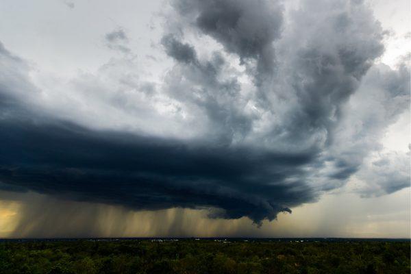
Tropical Storm Edouard is churning through the warm waters of the Gulf of Mexico, aiming for a landfall near the Texas-Louisiana line. The National Hurricane Center reports maximum sustained winds near 65 kilometers per hour, but conditions are ripe for rapid intensification before the storm reaches the coast. Emergency officials in both states have activated response plans to deal with storm surge, heavy rain, and the possibility of hurricane-force winds.
Rain, not wind, poses the biggest threat
Despite its relatively small wind field, Edouard's real danger lies in its rainfall. Forecast models project accumulations of 75 to 150 millimeters across the upper Texas coast, with isolated spots possibly seeing up to 230 millimeters. That kind of downpour could overwhelm drainage systems in cities like Houston, College Station, and even areas south of Dallas, leading to dangerous flash flooding.
Local meteorologists are stressing that the storm's slow movement could make things worse. "The ground is already saturated from recent rains," said one Houston-based forecaster. "We're telling people to prepare for water rising quickly, especially in low-lying neighborhoods."
Emergency preparations underway
Texas Governor Greg Abbott has confirmed that state emergency crews are being deployed to help coastal communities brace for the storm. Storm surge warnings are in effect from High Island, Texas, to Cameron Parish, Louisiana, where water levels could climb up to 1.5 meters above ground. Residents in vulnerable areas are being urged to finalize their safety plans, and officials are watching for the possibility of isolated tornadoes embedded in the outer rainbands.
For many in the region, this storm hits close to home. The Gulf Coast has a large Latino population, from the historic fishing communities of Galveston to the growing suburbs of Houston. Local leaders are using social media and community networks to spread the word in both English and Spanish, making sure everyone has the information they need to stay safe.
A quiet Atlantic season, but a busy Pacific
Edouard's arrival highlights an unusually calm 2026 Atlantic hurricane season. A strong El Niño has increased wind shear over the Caribbean and the Atlantic, suppressing tropical development. That pattern is also reshaping hurricane season in other parts of the world, putting places like Hawaii at unexpected risk.
Meanwhile, the Pacific Ocean is anything but quiet. Hurricane Karina, a Category 4 storm, is moving across open waters without posing an immediate threat to land. But forecasters are keeping a close eye on it, as well as on other systems that could develop in the coming weeks.
For now, all eyes are on Edouard. The storm is expected to make landfall within the next 24 to 36 hours, and the window for preparation is closing. As one emergency manager put it, "We've seen storms like this before, and we know that the rain can be just as deadly as the wind. Don't take chances."
Residents along the Gulf Coast are advised to monitor local weather reports, heed evacuation orders if issued, and check on neighbors who may need extra help. The storm may be compact, but its impact could be widespread.