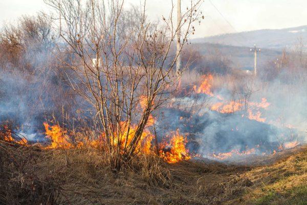
A fast-moving wildfire in the Santa Monica Mountains above Malibu has forced residents to evacuate as powerful Santa Ana winds continue to threaten Southern California. The Bryson Fire, which ignited Thursday near Encinal Canyon Road and Mulholland Highway, has already scorched roughly 147 acres and put communities along the rugged coastline on high alert.
By Friday morning, fire crews had managed to increase containment from 5% to 17%, a sign of progress against the blaze. More than 285 firefighters worked through the night, using hand lines and air support to slow the flames. Still, officials warn that the combination of steep terrain, dry brush, and gusty winds could quickly change the fire's behavior.
Where is the fire heading?
The flames initially pushed south and southwest toward the Pacific, placing western Malibu and the canyon communities under the most immediate threat. Areas near Encinal Canyon, Kanan Road, and the coastal mountains are being watched closely. While the fire is not currently advancing toward downtown Los Angeles, shifting winds could alter its path at any moment.
The National Weather Service has issued a red flag warning, with Santa Ana wind gusts expected to reach up to 70 mph in some mountain areas. These conditions—strong winds, low humidity, and parched vegetation—create the perfect recipe for rapid fire spread and flying embers that can ignite new spot fires miles ahead of the main blaze.
For many in the region, this feels like a familiar threat. The 2025 wildfire season left deep scars across California, and the memory of those devastating fires is still fresh. However, officials stress that the Bryson Fire is currently far smaller in scale, and no fatalities or destroyed homes have been confirmed as of Friday morning.
Evacuations and community response
Mandatory evacuation orders are in effect for zones KAN-U017 and SYC-U016-A, while 12 additional zones, including parts of Malibu, are under evacuation warnings. An emergency shelter has been set up at Agoura High School, and residents are being urged to stay informed through Genasys Protect, the county's evacuation mapping tool.
Local authorities are also reminding residents to prepare go-bags and have a plan in place, especially those living in the narrow canyon roads that can become bottlenecks during an evacuation. The fire has already disrupted daily life, with road closures and school cancellations in some areas.
This latest blaze comes on the heels of other fire-related challenges across the state, from the Brentwood brush fire that was recently contained to the ongoing concerns about coastal infrastructure along the Pacific Coast Highway. The region's vulnerability to climate-driven extremes is becoming increasingly clear, as one woman's climate ordeal illustrates.
For the Latino communities scattered across the Santa Monica Mountains and the broader Los Angeles area, the fire is a reminder of the shared risks that come with living in this beautiful but volatile landscape. Many families have deep roots here, and the threat of losing homes and livelihoods is a heavy burden.
Fire officials are cautiously optimistic that the containment lines will hold, but they emphasize that the next 48 hours are critical. The Santa Ana winds are expected to peak Saturday evening, and any shift in direction could bring the fire closer to populated areas.
Residents are advised to stay alert, follow evacuation orders, and check on neighbors who may need assistance. As one firefighter put it, "We're in this together, and we'll get through this together."