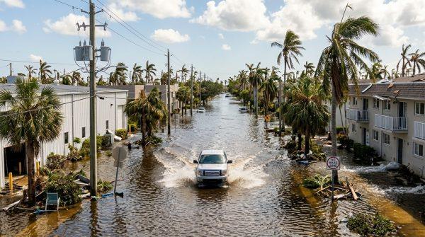
For much of South Florida, the last week of October has brought an unwelcome sight: ocean water creeping over seawalls, pooling in intersections, and turning familiar streets into temporary canals. The seasonal king tides—the highest tides of the year—have combined with strong onshore winds and heavy rain to flood low-lying communities from Miami-Dade to Palm Beach County. The National Weather Service in Miami has issued alerts through October 31, warning that conditions could worsen before they improve.
Meteorologist Donal Harrigan, who has been tracking the event, expects major flooding escalation as sea level rise and persistent winds push Atlantic waters inland. “Any location currently wet from high tide will see those conditions aggravated by incoming rain,” he said. The forecast calls for 1 to 2 inches of rain across coastal counties, adding to the surge already overwhelming drainage systems.
Peak tides and dangerous conditions
Tidal levels are projected to reach their absolute maximum on Tuesday and Wednesday, with water rising up to 2.5 feet above normal. The most intense flooding is expected in the hour before and after high tide. In Miami-Dade, that means peak flooding around 9 a.m. and 9 p.m. on Sunday, 9:45 a.m. and 9:45 p.m. on Monday, and 10:30 a.m. and 10:30 p.m. on Tuesday. Broward County will see similar peaks, slightly offset, with high tides at 8 a.m. and 8 p.m. Sunday, 9 a.m. and 9 p.m. Monday, and 9:45 a.m. and 9:45 p.m. Tuesday.
Adding to the chaos, a low-pressure system is generating tropical-storm-force gusts near 45 mph. Harrigan warned that marine conditions are “completely unsafe” for boating or beach visits. The combination of wind and high water has already caused significant disruptions, including a video shared by meteorologist James Wieland showing flooding along Flagler Drive in downtown West Palm Beach.
University of Miami hurricane researcher Brian McNoldy reported on Bluesky that Virginia Key recorded water levels 1.6 feet above normal, marking five consecutive days of moderate inundation—and he expects that to continue for another four to five days.
Infrastructure under pressure
Municipal leaders are spending millions on elevated roads, stormwater pumps, and other upgrades to protect vulnerable areas. These projects are part of a long-term adaptation strategy, but they are racing against a rapidly changing baseline. Historical data shows that while sea levels took 80 years to rise one foot, eight inches of that rise occurred in just the last 30 years. Scientists project the next foot will take only 30 years, and the one after that just 20.
For urban planners, this week’s flooding is a preview of what’s to come. “We’re seeing the future of Miami’s streets,” said one local engineer involved in resilience projects. “Every king tide gives us a chance to test our systems and learn what needs to be fixed.”
Residents in affected neighborhoods are adapting as best they can. In Brickell, some condo buildings have become unexpected hubs of activity as people seek higher ground, while others are simply waiting it out. The flooding has also disrupted daily commutes, with some roads closed and traffic diverted.
State emergency management teams are maintaining constant vigilance in coastal districts, ensuring safety protocols are in place. But as Harrigan notes, the real challenge is long-term. “These events are becoming more frequent,” he said. “We need to plan for a future where high tides regularly reach our doorsteps.”
The current king tide cycle is expected to continue through October 31, with additional peaks forecast for November 6-9 and November 23-26. For South Florida, the message is clear: the ocean is rising, and the streets are feeling it.