A vast, slow-moving pulse of warm water is making its way up the Pacific coast, and California is bracing for its effects. Known as a Kelvin wave, this phenomenon can push sea levels a foot higher than normal in vulnerable areas, amplifying the risk of flooding during high tides and winter storms.
Unlike the crashing waves surfers chase, a Kelvin wave is a silent, subsurface swell that spans hundreds of miles. It doesn't break on the sand; instead, it travels along the coastline, displacing enormous volumes of warm water. Scientists at NASA's Jet Propulsion Laboratory have been tracking this particular wave since it passed South America in August, and it's now approaching the U.S. West Coast.
What's driving the surge?
Kelvin waves are often linked to shifts in Pacific trade winds. When those winds weaken, warm water that was piled up in the western Pacific sloshes back eastward, creating a wave that rides the equator and then turns north or south along continental shelves. In this case, the wave is moving up the California coast, and its arrival coincides with the start of the winter storm season.
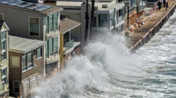
NOAA specialists explain that when coastal winds ease, the accumulated warm water can release abruptly toward the shore. That's when a 1,000-mile-wide wave becomes a tangible threat. The extra foot of water can push floods further inland, worsen beach erosion, and put roads, homes, and businesses at greater risk.
This temporary rise compounds the long-term trend of sea level rise driven by climate change. California's coasts are already about 8 inches higher than they were a century ago, and events like this Kelvin wave add a short-term spike on top of that baseline. As experts note, the lack of direct visibility makes it harder for the public to grasp the real danger, even as erosion continues day by day.
Local vulnerabilities and preparation
Coastal communities are no strangers to high tides, but the combination of a Kelvin wave and seasonal storms can push water into places it doesn't usually reach. Municipal drainage systems can back up when high tides coincide with the surge, and emergency agencies are updating their response protocols to issue earlier warnings.
Local advisories are urging residents to pay close attention to tidal forecasts and flood warnings, especially around the Thanksgiving and Christmas holidays, when very high tides are expected. Urban planners are also reviewing building standards and emergency plans to reduce potential damage across the coastal strip.
For those living near the shore, the message is clear: don't underestimate the power of an invisible wave. Even if it doesn't make headlines like a hurricane, its effects can be just as disruptive. As one observer put it, "The ocean doesn't have to roar to remind us who's in charge."
This event also highlights the importance of long-term climate resilience. While a Kelvin wave is a natural occurrence, its impacts are magnified by rising seas. Cities like San Diego, Los Angeles, and San Francisco are investing in coastal defenses, but the challenge is immense. For a deeper look at how El Niño keeps California coasts elevated for months, check out our earlier analysis.
As the wave moves through, researchers will continue to monitor its progress and refine their models. The data collected will help improve forecasts for future events, giving communities more time to prepare. In the meantime, the best advice for coastal residents is to stay informed and heed local warnings.
For more on how California is mapping flood-prone zones, see our coverage of similar efforts in other states. And if you're wondering how this winter's weather might affect your region, our report on Texas flooding offers a glimpse of the broader pattern.
Ultimately, the Kelvin wave is a reminder that the ocean is never static. It moves, breathes, and occasionally surprises us. For California, this event is a test of resilience—and a call to pay attention to the subtle signals that precede bigger changes.