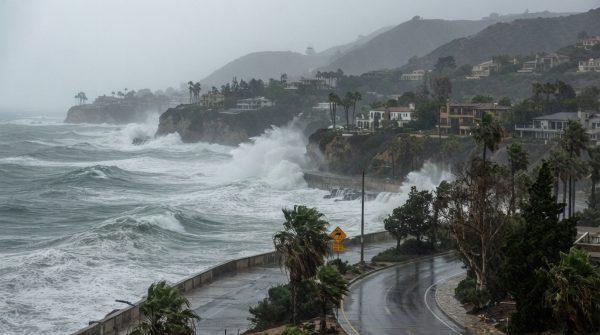
Hurricane Polo is churning through the eastern Pacific, and while its center is expected to make landfall on the Baja California peninsula, its reach extends far beyond the coast. Forecasters warn that the storm's tropical moisture will push into California and the broader Southwest, bringing heavy rainfall and the risk of flooding to communities that are no strangers to drought but are less accustomed to sudden deluges.
As of the latest updates from the National Hurricane Center, Polo is packing maximum sustained winds of 115 mph, making it a strong Category 3 hurricane. The storm's trajectory has it moving north-northeast toward the peninsula, with a projected landfall that could bring it near the southern tip of Baja California Sur. Over the following hours, forecasters expect the system to weaken as it interacts with the rugged terrain of mainland Mexico, but not before it unleashes significant precipitation across a wide area.
Meteorologists are tracking rainfall totals that could reach up to 10 inches in some locations, particularly in mountainous regions and areas with poor drainage. The combination of saturated soils and steep slopes raises the specter of landslides, especially in communities nestled in the foothills of Southern California and the desert southwest. The National Weather Service has issued flood watches and warnings for parts of the region, urging residents to stay alert and prepared.
State of emergency and local preparedness
California Governor Gavin Newsom has declared a state of emergency for several counties, a move that accelerates the deployment of resources and personnel to vulnerable areas. Emergency management agencies are opening shelters in zones identified as high-risk for flooding, and public safety teams are monitoring mountain passes and coastal highways where debris flows could pose a threat. Transportation authorities have already imposed temporary restrictions on some routes, and residents are being advised to avoid unnecessary travel during the peak of the storm.
In communities across the state, local officials are working to shore up infrastructure and communicate preparedness plans. Municipal crews are clearing storm drains and reinforcing levees, while community organizations are distributing guides on how to assemble emergency kits and develop family communication plans. The message is clear: this is not a typical winter storm, and the potential for flash flooding is real.
For many Latinos in California, the storm's approach brings back memories of past weather events that have disproportionately impacted immigrant and working-class neighborhoods. In places like the Central Valley and the Inland Empire, where many families live in mobile homes or older housing stock, the threat of flooding is especially acute. Local leaders are emphasizing the importance of heeding evacuation orders and not waiting until the last minute to move to higher ground.
Wider regional impact
While California is the primary focus, the storm's influence extends into Arizona, New Mexico, and even the northwestern corner of Texas. These areas, often parched and unaccustomed to heavy rain, could see flash flooding in washes and arroyos, which can be particularly dangerous. The National Hurricane Center's projections indicate that the remnants of Polo could bring a secondary landfall in northwestern Mexico between Monday night and early Tuesday morning, further complicating the regional weather picture.
Agricultural experts are also keeping a close eye on the storm. Excessive moisture can damage crops, especially those nearing harvest, and can lead to soil erosion and fungal diseases. The economic impact could be significant for farming communities that are already grappling with water scarcity and rising costs. Insurance providers are bracing for a wave of claims, and state agencies are preparing to assess damages once the storm passes.
This event comes on the heels of a year that has already seen its share of extreme weather, from the El Niño-driven coastal erosion to the explosive growth of Hurricane Polo in the Pacific. For Californians, the storm is a reminder that the state's climate is changing, and that preparedness is not just a seasonal concern but a year-round one.
As the storm progresses, officials are urging residents to stay informed through local news and official channels. The coastal risks extend beyond the storm's path, and even areas far from the landfall could see impacts. For now, the focus is on safety, and on ensuring that communities—especially those that are most vulnerable—have the support they need to weather the storm.
In the coming days, as the storm moves inland and dissipates, the true extent of the damage will become clearer. But for now, the message from officials is simple: take the threat seriously, prepare for the worst, and look out for one another. In a state as diverse as California, that sense of community is often the strongest defense against nature's fury.