El Niño is back, and this time it's packing a punch. Federal forecasters are tracking unusually warm waters in the tropical Pacific, setting the stage for a winter that could upend typical weather patterns across the United States. From the coasts to the mountains, communities are bracing for everything from heavy snow to flash floods.
The National Oceanic and Atmospheric Administration (NOAA) has been monitoring this developing event closely. Their latest data shows an 83% probability that El Niño will reach strong or very strong intensity between January and March 2027, with a 75% chance of hitting historic levels as early as October through December of this year. That's a big deal for anyone planning winter travel or managing infrastructure.
NOAA is set to release its official seasonal outlook on Thursday, October 15, which will provide more details on how these oceanic anomalies might complicate weather predictions. In the meantime, emergency management officials are urging residents in vulnerable areas to clear drainage systems and reinforce structures before the worst hits.
How El Niño reshapes winter weather
Warm equatorial Pacific waters are already driving shifts in the jet stream, which in turn alters storm tracks across the continent. Meteorologists at NOAA's Climate Prediction Center have identified three key ways this El Niño will transform regional precipitation and temperature patterns.
1. More moisture for the West Coast
Pacific storm systems are expected to barrel into the western states, bringing heavy rain and snow. This could be a boon for drought-stricken areas, but it also raises the risk of flooding and mudslides, especially in low-lying basins and along the coast.
2. Snowfall surprises in the mountains
Temperature contrasts will be sharper than usual, leading to sudden shifts between rain and snow. This creates hazardous conditions for travel and can stress infrastructure, particularly in mountain passes and high-elevation communities.
3. Flood risks in the lowlands
With repeated storms hitting saturated ground, flash flooding becomes a real threat. Coastal cities are already advising residents to clear storm drains and secure property, especially as atmospheric rivers make landfall.
California is on the front lines. The Washington Post's Weather Center has analyzed the potential for atmospheric rivers to bring heavy rain, urban flooding, and beach erosion starting in December. Marty Ralph, director of the Center for Western Weather and Water Extremes at Scripps Institution of Oceanography, recalls how warmer coastal waters amplified thunderstorm energy around Santa Barbara during the powerful 1997-1998 El Niño. That's a warning for what could come.
Colin McCarthy from Atmo AI Research projects that mountain elevations above 2,100 to 2,400 meters (7,000 to 8,000 feet) will see massive snowfall. But ski resorts at lower elevations, around 1,800 meters (6,000 feet), might get rain instead, which could accelerate melting and increase avalanche risk. Emergency agencies are calling for investments in public safety to protect neighborhoods from potential mudslides.
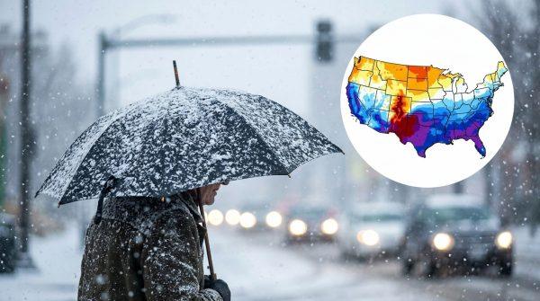
Looking east, independent meteorologists cited by the Daily Mail have identified a high-risk corridor stretching from Oklahoma through Arkansas, Tennessee, Kentucky, the Appalachians, the Carolinas, and Virginia. Ryan Hall and Direct Weather note increased confidence in snowstorms, ice events, and nor'easters hitting the East Coast. Meanwhile, The Weather Channel predicts warmer, drier conditions early on for the Pacific Northwest, Northern Rockies, Northern Plains, Midwest, New England, and New York.
For the Central and Southern Rockies in Utah and Colorado, plus the Sierra Nevada, the outlook is promising for abundant snowfall thanks to an active storm track. That's good news for ski enthusiasts, but it also means being prepared for winter driving conditions.
As El Niño continues to strengthen, staying informed is key. For those planning trips or managing properties, keeping an eye on forecasts and heeding local warnings can make all the difference. And for a broader perspective on how this winter might unfold, check out our super El Niño forecast for Texas and California.
In the meantime, communities across the country are taking proactive steps. Whether it's clearing drains in Los Angeles or stocking up on supplies in Nashville, preparation is the name of the game. After all, El Niño doesn't care about state lines—it's a force of nature that touches us all.