The Atlantic hurricane season has roared back to life. Tropical Storm Isaias, which formed earlier this week in the southwestern Gulf of Mexico, is now barreling toward the U.S. Gulf Coast with increased intensity. Forecasters expect the system to strengthen into a Category 2 hurricane before it makes landfall, bringing with it a dangerous combination of storm surge, torrential rain, and damaging winds.
As of the latest advisory from the National Hurricane Center, Isaias is moving northeast at roughly 8 mph. The storm's maximum sustained winds have already reached 70 mph, and the low-pressure system is drawing energy from the exceptionally warm waters of the Gulf. This rapid intensification has prompted urgent warnings from meteorologists, who are tracking the storm's path with growing concern.
States of Emergency Declared
In anticipation of a potentially devastating impact, Florida Governor Ron DeSantis has declared a state of emergency for 25 counties along the state's Gulf coast. The declaration allows for the mobilization of National Guard troops and the pre-positioning of resources, including sandbags, high-water vehicles, and search-and-rescue teams. Local officials are urging residents in low-lying areas to review their evacuation plans and heed all warnings from emergency management.
Louisiana is also bracing for a significant hit. Governor Jeff Landry has issued a similar emergency declaration, with the New Orleans metro area and the bayou communities to its south expected to feel the storm's fury. The city's drainage system, while improved since Hurricane Katrina, will be tested by the forecasted rainfall, which could reach 10 inches in some isolated spots.
Forecast Track and Potential Impact
The latest computer models show Isaias making landfall late Friday night or early Saturday morning somewhere between the Florida Panhandle and southeastern Louisiana. The storm's large wind field means that impacts will be felt far from the center of circulation. Coastal areas from Mobile Bay in Alabama to the Big Bend region of Florida are under hurricane watches and warnings.
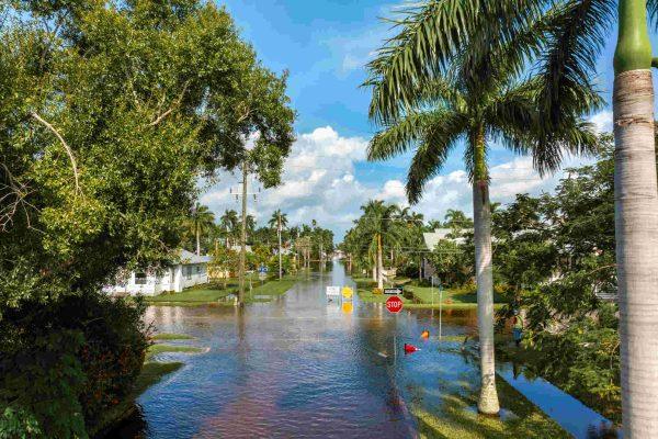
Storm surge is expected to be the greatest threat to life and property. Forecasters are predicting a surge of 6 to 9 feet above normal tide levels in the most vulnerable areas, which could inundate coastal roads and homes. The National Weather Service has also warned of the potential for isolated tornadoes, a common feature of landfalling tropical systems.
Beyond the immediate coast, the storm is expected to weaken as it moves inland, but heavy rain will continue to be a major hazard. The system is forecast to stall over the southeastern United States, leading to a multi-day rainfall event that could cause significant flash flooding and river flooding across parts of Georgia, Alabama, and the Carolinas.
For the Latino communities scattered across the Gulf Coast, from the Cuban enclaves of Tampa to the Honduran and Mexican neighborhoods of New Orleans, this storm is a stark reminder of the region's vulnerability. Many families have deep roots in these coastal areas and have weathered past storms, but each new hurricane brings its own unique challenges. Community leaders are working to ensure that information is disseminated in both English and Spanish, so that no one is left without the resources they need to stay safe.
Residents are advised to monitor local news and official weather channels for the latest updates. The time to prepare is now. Have a plan, know your zone, and be ready to act if evacuation orders are issued.